Steven Nerem
Professor of Aerospace Engineering Sciences
- Ph.D., University of Texas at Austin, 1989
Research Interests
My research involves using satellite-based geodetic techniques to monitor changes in the Earth’s shape and gravity field. The former deals mainly with global and regional changes in sea level and vertical crustal motion. The latter deals with changes in the distribution of water and ice on the Earth’s surface. My research group tries to decipher what is causing changes in these variables, including the impact of climate change. I am also interested in astrodynamics and work on developing satellite missions to measure these phenomena. I’ve been closely involved in the TOPEX, Jason-1, -2, -3, GRACE, and GRACE Follow-On missions.
Current Research
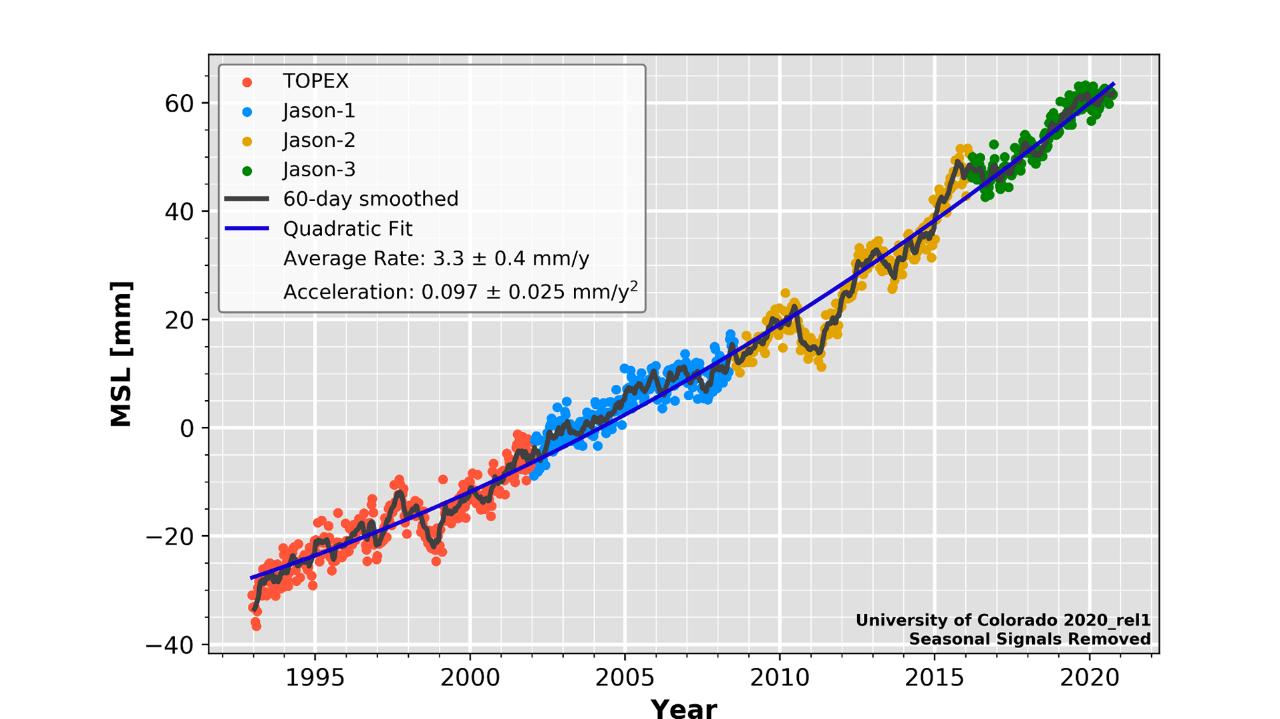
Recently, my research group been focused on determining if global sea level rise has accelerated over the 25-year satellite altimeter record from TOPEX, and Jason-1, -2, and -3. In doing such an analysis, we must account for phenomena as diverse as the eruption of Mt. Pinatubo in 1991 and the influence of ENSO variability. We must also carefully assess the measurement errors and the influence of decadal variability on a relatively short 25-year record. While we are still completing this research, it appears that long-term sea level rise has accelerated from roughly 2 mm/year in the mid-1990s to 4 mm/year today (2017). The GRACE satellite tells us that most of this acceleration is coming from the loss of ice mass in Greenland and Antarctica. If this acceleration were to continue unchanged into the future, sea level would be rising at a rate of ~10 mm/year in 2100. Our future research is focused on improving this analysis and its errors, and better understanding how sea level might change in the future. We are also looking forward to the launch of the GRACE Follow-On mission in early 2018. Together, satellite gravity and satellite altimeter measurements tells us how much sea level is changing and why it is changing. This work is funded through the NASA Sea Level Change Team (N-SLCT).
Research Categories
Climate and Weather, Oceans, Solid Earth, SpaceResearch Images
to
Invalid date -Sponsors
-
Invalid dateP.I.(s)
About CECA
CECA connects and creates a supportive environment for graduate students and postdocs who come from various academic units to do research in CIRES.
