Better daily sea ice forecasts for the Arctic following CU Boulder-led innovation
Ice experts from the University of Colorado Boulder, the U.S. Navy, the U.S. National Ice Center and other institutions have developed a straightforward new technique for estimating sea ice concentration in the Arctic Ocean, and the new method improves the U.S. Navy’s sea ice forecast by almost 40 percent. With shipping on the rise in the Arctic Ocean, improving these short term forecasts makes navigating in Arctic waters safer.
The Navy, the National Oceanographic and Atmospheric Administration (NOAA) and others have been seeking to improve sea ice forecasts, said Pamela Posey of the U.S. Naval Research Laboratory in Mississippi. In the remote Arctic, unanticipated sea ice can slow science research vessels and create problems for Navy submarines.
“It’s especially important to have accurate forecasts given rapidly changing conditions in the Arctic,” Posey said.
The new system—which captures current sea-ice conditions more accurately and in greater detail by blending several streams of data—has been used operationally in Navy forecasting since February, Posey said. Florence Fetterer with the National Snow and Ice Data Center (NSIDC) and colleagues developed the blended input approach, and NRL has now shown it improves 6-hour forecast accuracy by 40 percent year-round. During the summer, forecasts improved even more than that, they reported in a paper in The Cryosphere, a journal of the European Geosciences Union.
NSIDC is part of the Cooperative Institute for Research in Environmental Sciences (CIRES) at the University of Colorado Boulder, a partnership of CU Boulder and NOAA.
The new ingredients now going into the Navy’s official sea ice forecasts are satellite data and human interpretation of sea ice presence or absence from satellite sources, said Pablo Clemente-Colón, Chief Scientist of the U.S. National Ice Center (NIC), a collaboration of the Navy, NOAA and the U.S. Coast Guard. “This is one of the first times that human analysis is ingested operationally into a major forecast model,” he said.
A couple years ago, Posey and others recognized that sea ice forecast models—used by Navy submarines, the U.S. Coast Guard and many others just as they use weather forecasts—had improved, with more detailed or “higher resolution” output. But just as with weather forecasts, these models have to start with accurate initial conditions, and observations of sea ice had not kept pace with models. The Naval Research Laboratory asked experts at NSIDC to see what could be done.
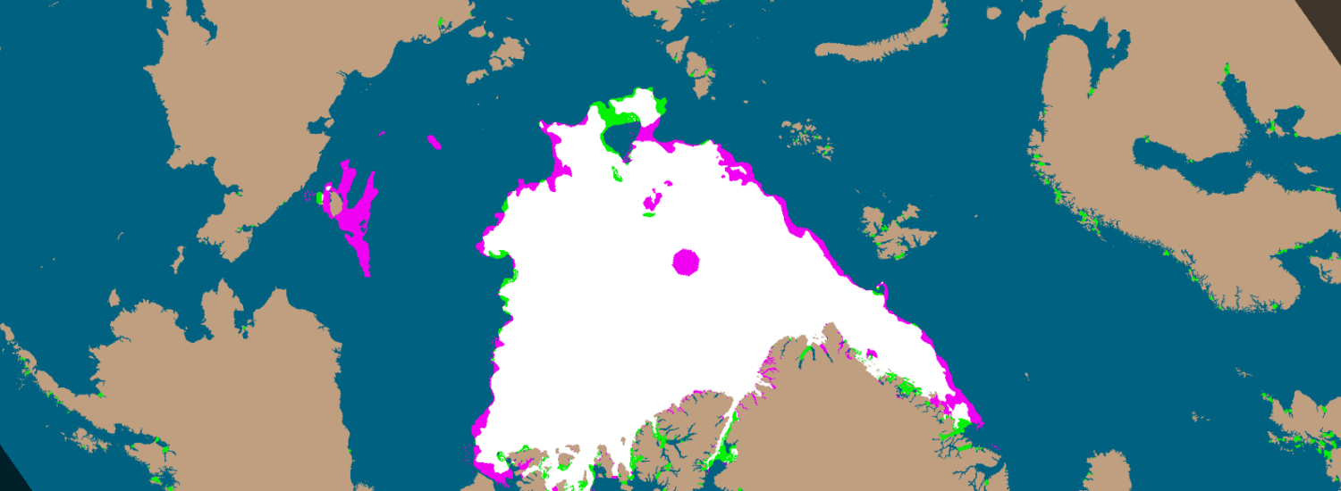
“Our idea was pretty simple, to combine two types of measurements,” said Fetterer, a CIRES scientist who is NSIDC’s NOAA liaison. With colleagues from NASA, the NIC and the Naval Research Laboratory, Fetterer blended data from the high-resolution satellite-based Advanced Microwave Scanning Radiometer 2 (AMSR2) with MASIE (“may-zee,” the Multisensor Analyzed Sea Ice Extent), itself a blended product that includes human interpretation of many satellite imagery sources as well as other information. The MASIE product often catches ice that the microwave data alone miss, especially in summer, when melt ponds on the surface of the ice appear as ocean to the sensor. Where there is ice, the AMSR product supplies an estimate of ice concentration that the forecast model needs.
The resulting high-resolution dataset can capture even small patches of sea ice a few miles across, which are easy to miss in some satellite datasets. That means better input into forecasts, and more accurate output, too. “We expect this combined product is going to do a much, much, much better job at initializing the Navy’s forecast model,” Fetterer said.
“It is really helping us, and it’s providing a better product for the whole community that uses and depends on accurate sea ice information from forecast modelers to anybody with assets in the Arctic,” Clemente-Colón said.
CIRES is a partnership of NOAA and CU Boulder.