Losing Its Cool
The Greenland Ice Sheet may be losing more glacial mass than previously estimated
Measuring just how much mass a glacier is losing—through melting and calving—is no easy task. While there’s plenty of satellite data from space, scientists haven’t had access to much local, on-the-ground observation, which is the sort of information that’s necessary to more accurately measure glacial mass loss. But now a team of scientists, including CIRES’ Mike Willis, have put a series of GPS systems in place that give them the kind of data they need. Using that information, they find that previous estimates of mass loss from the Greenland Ice Sheet—already known to be shrinking—may be underestimates. Their study is out today in Science Advances.
![]() CIRES Fellow Mike Willis installs a GPS unit in Greenland. Photo courtesy Mike Willis.
CIRES Fellow Mike Willis installs a GPS unit in Greenland. Photo courtesy Mike Willis.
Willis, who’s also a glaciologist with the University of Colorado Boulder’s Department of Geological Sciences, has spent decades studying the Earth’s ice sheets, including Greenland’s. Over the past two decades, the Greenland Ice Sheet has lost mass as glaciers around the edge flow faster into the ocean and melting in the interior increases in area and duration. Recent work comparing old aerial photographs with modern measurements of the ice show that the basins of the southeast, east and northwest of the ice sheet have contributed to 77 percent of its total mass loss to the ocean over the last century.
To get more precise measurements of ice mass change for the past decade, Willis and his colleagues installed 55 GPS units along the edges of the ice sheet to make accurate measurements of how the Earth’s crust is responding to nearby changing ice. “Those GPS units measure the weight of the atmosphere, winds, ocean tides,” says Willis. “Snowfall in winter, melt in summer—they’ll measure those changes, too, because the land bends ever so slightly, fractions of a millimeter, in response to the changing loads. And if you get a glacier that breaks off and floats away—this sends a much bigger signal.”
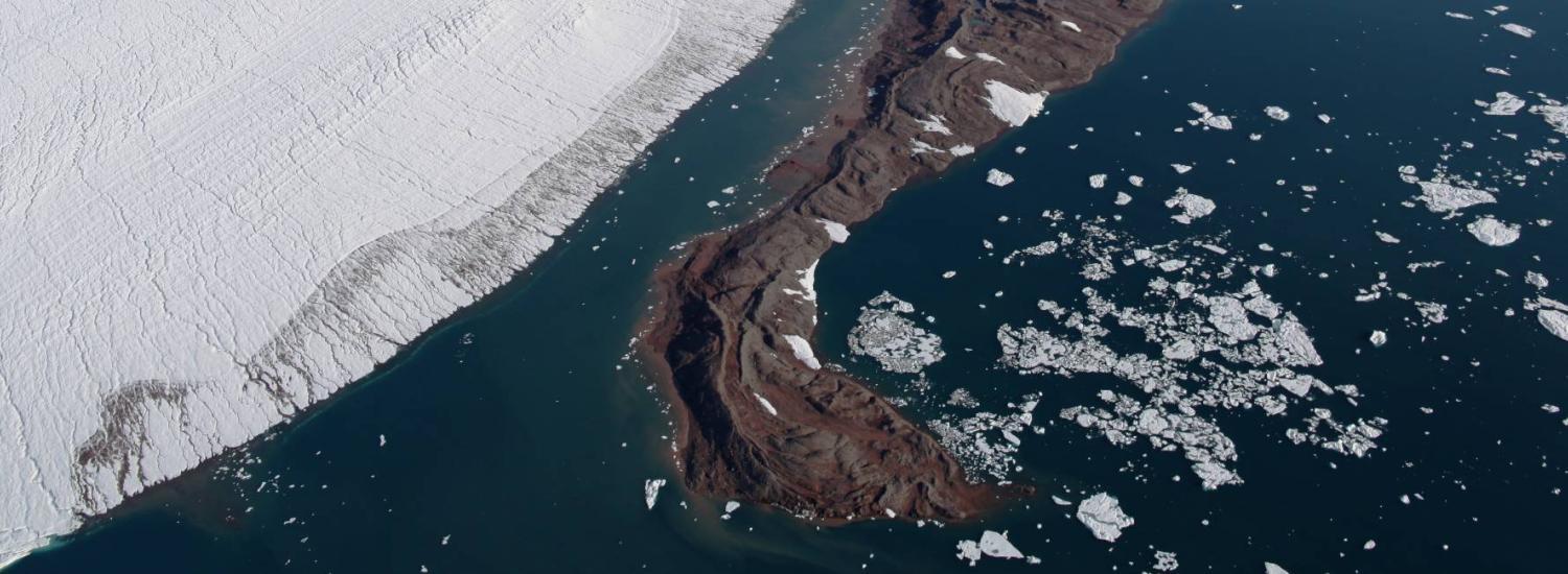
Huge calving event at Helheim Glacier on the east coast of Greenland. Willis estimates The piece breaking off is about 1 km deep, by 1 km wide by 500 m long, so about half a gigatonne (metric) of ice. Credit: Nikolaj Krog Larson
Their measurements showed that recent estimates of modern mass loss from Greenland Ice Sheet are about 10 percent too low. That’s in large part because, as glaciers melt and flow from the land into the sea, the amount of ice on the land goes down and the land on which it sat rebounds slightly. The GPS, on nearby bedrock measures that rebound, something that previous estimates of Greenland's bedrock motion couldn't account for properly. That movement is part of a process known as glacial isostatic adjustment (GIA), which is the Earth’s response to ice sheet changes combined over both long and relatively short timescales. The GPS results showed that there were large GIA uplift rates of around 12 millimeters per year in southeast Greenland.
The team, led by Technical University of Denmark’s Abbas Khan, used modern-day information about ice changes to model the short term effects on the GPS stations. They removed this signal from the combined measurements made by the GPS units to figure out the signal caused by long-term changes in ice mass over the last several millennia. Their data showed it’s the same basins in the southeast, east and northwest of the ice sheet that are contributing rapidly to sea level today, that contributed about 40 percent of the ice mass loss over the past few thousands years and that, overall, Greenland had lost more mass in the past than was previously thought. Additionally, by comparing old GIA models with the current results, they found that Greenland mass loss since the Last Glacial Maximum (21 thousand years ago, at the height of the last Ice Age) was underestimated by about 1.5 meters.
“Knowing that gives us insight into Greenland’s contribution to sea-level rise over the long run,” says Willis.