CIRES Science @ #AGU17
Talks and posters by CIRES scientists, events and more CIRES @ #AGU17
Click for daily highlights:
Monday, 11 December
![]()
MONDAY MORNING PRESENTATIONS
Times and locations as indicated below
Landslide and tsunami in Karrat Fjord, Greenland, 2017: The event, the response and the future
CIRES Ph.D. student Magali Barba and lead author Kirsty Langley demystify the sequence of events that led up to a deadly landslide-triggered tsunami in Karrat Fjord, Greenland, on the evening of June 17, 2017. Part of a rocky slope plunged into the fjord below and caused a tsunami, killing four people in a remote village. The team used optical and photogrammetric data, tsunami modelling, and detailed digital elevation mapping (DEM) data to study the landslide—and the leadup. And they took it a step further, using their findings to identify parts of the slope that remain unstable today—information that’s critical for emergency response teams and others trying to plan for the future.
Kirsty Langley (Asiaq, Greenland Survey) with CIRES co-author Magali Barba
PA11C-05, 08:54 - 09:04, Convention Center 255-257
Space weather forecasting at NOAA with Michigan’s Geospace Model: Results from the first year in real-time operations
NOAA’s Michele Cash and CIRES’ George Millward present an analysis of the overall performance of the Geospace Model during the first year of real-time operations. The Geospace Model, developed at the University of Michigan, simulates the full time-dependent 3D Geospace environment and predicts global space weather parameters as well as regional magnetic pertubations on Earth’s surface that can cause harm to communications and navigation systems. The team will also discuss new products available in a recent upgrade to the Geospace Model.
Michele Cash (NOAA) with CIRES co-author George Millward
SM11E-07, 09:00 - 09:10, Convention Center 243-244
The state of the Arctic carbon cycle from an atmospheric perspective
CIRES/NOAA’s Colm Sweeney presents preliminary results from the Arctic Boreal Vulnerability Experiment (ABoVE) airborne survey, which is investigating fluxes of greenhouse gases carbon dioxide and methane across Alaska and Northwestern Canada. The mission is allowing scientists to constrain estimates of the impact of climate change on the Arctic’s carbon cycle. Despite much speculation, the Arctic methane budget appears to be somewhat resilient to recent climate change; by contrast, atmospheric carbon dioxide dynamics are changing significantly.
Colm Sweeney (CIRES & NOAA Boulder)
B11J-08, 09:45 - 10:00, Convention Center 356-357
Innovating data discovery in NOAA OneStop by integrating with social media
CIRES/NCEI’s Arianna Jakositz highlights experiments with using social media (mainly YouTube) to attract users to the data and tools in NOAA’s new OneStop portal. The OneStop team was tasked with improving discovery of and access to NOAA’s enormous troves of data; Jakositz will also discuss the ways in which a user can discover varying data types—weather, climate, fisheries, coasts, and more—from the portal.
Arianna Jakositz (CIRES & National Centers for Environmental Information Boulder)
IN12A-02, 10:26 - 10:29, Convention Center eLightning Area
Leveling the field: The role of training, safety programs, and knowledge management systems in fostering inclusive field settings (Invited)
Knowledge is empowering, and it can play a particularly important role in empowering under-represented groups in field research. History and tradition have created some high barriers for women and minorities interested in field work, especially polar field work. The success of these participants is often contingent on the availability of specialized training opportunities or the quality of explicitly documented information. Advancement of field training programs and knowledge management systems can level the playing field and improve the experience of field work for all participants.
Sandra Starkweather (CIRES & NOAA Boulder)
U12A-02, 10:40 - 11:00, Convention Center E2
Creating inclusive and diverse field and lab environments within the geosciences (lunchtime panel discussion)
Sandra Starkweather (CIRES & NOAA) will be part of a panel discussion led by Marcia K McNutt, American Association for the Advancement of Science. 11:05-12:20, Convention Center E2
MONDAY MORNING POSTERS
08:00 - 12:20 All sessions take place in Convention Center Poster Hall D-F.
Changing conditions in the Arctic: An analysis of 45 years of tropospheric ozone measurements at Barrow Observatory (poster A11K-2020)
CIRES/NOAA’s Audra McClure-Begley took advantage of the unique long-term ozone time series data collected from the Barrow station in Utqiagvik, Alaska, to study the frequency of and reasons for ozone anomalies. Her work investigates ozone depletion events and the roles of pollutants, wildfires, and more. Audra McClure-Begley (CIRES & NOAA)
Characterization of ice nucleating particles during continuous springtime measurements in Prudhoe Bay: an Arctic oilfield location (poster A11K-2032)
By characterizing ice-nucleating particles, CIRES/NOAA’s Jessie Creamean seeks to understand how aerosols can change the properties of Arctic clouds. Results from a 2017 aerosol sampling campaign called INPOP (Ice Nucleating Particles at Oliktok Point), can ultimately inform our understanding of how aerosols found near oil exploration activities impacts Arctic cloud composition and formation. Jessie Creamean (CIRES & NOAA)
Interactive and approachable web-based tools for exploring global geophysical data records (poster ED11C-0139)
CIRES/NCEI graduate researcher Michael Croteau and his team have developed a web-based, interactive mapping and plotting tool that provides easy access to geophysical data—breaking down barriers for both scientists and nonscientists. This presentation features how the tool can facilitate access to terrestrial water data from the GRACE satellite, data that are notoriously difficult for non-experts to use correctly. Michael Croteau (CIRES & National Centers for Environmental Information)
MONDAY AFTERNOON PRESENTATIONS
Times and locations as indicated below
Water security and adaptive capacity for climate: Learning lessons from drought decision making in U.S. urban contexts
CIRES Fellow Lisa Dilling explores the question: Do decisions made to cope with drought help cities build the adaptive capacity necessary for adapting to climate change? Dilling and her team conducted interviews with drought management decision-makers across the United States to understand responses to drought and perceptions of their effectiveness—and analyzed whether these policies would build adaptive capacity for climate change. Their results suggest the need to investigate both the technical feasibility of proposed adaptation solutions—and their political and social dimensions.
Lisa Dilling (CIRES & CU Boulder)
H13S-02, 13:55 - 14:10, Convention Center 280-282
Characterizing drought risk management and assessing the robustness of snowpack-based drought indicators in the Upper Colorado River Basin
In the Upper Colorado River Basin during the last 20 years, drought conditions have coincided with a period of increasing water demands. CIRES Fellow Ben Livneh, along with CIRES Fellow Lisa Dilling led a team that used interviews, document analysis, and other techniques to first examine how water managers on Colorado’s Western Slope perceive drought-related risk, use and access drought information, and respond to drought. Since water managers identified snowpack-based drought indicators as the most useful and reliable drought indicator, Livneh then used simulations and models to examine how those snowpack-based factors are likely change in a warmer world, and whether those changes will affect the robustness of drought indicators.
Ben Livneh (CIRES & CU Boulder)
H14H-01, 16:00 - 16:15, Convention Center 280-282
MONDAY AFTERNOON POSTER
13:40- 18:00 Convention Center Poster Hall D-F.
Meltwater-induced changes in the structure and behavior of Greenland’s firn (poster C13F-1016)
CIRES’ Mike MacFerrin is investigating a critical climate-related change to Greenland’s firn, or compacted snow: ice slabs created when melt water is refrozen near the surface. His work reveals that ice slabs cover approximately 5 percent of the accumulation zone of the ice sheet today, and model results show they could cover 15-50 percent of Greenland’s interior by 2100. These changes not only affect the amount of runoff that flows off the ice sheet, but also challenge the assumptions we make when measuring how much mass Greenland loses on multi-year time scales. Michael MacFerrin (CIRES & CU Boulder)
Tuesday, 12 December
![]()
TUESDAY MORNING PRESENTATIONS
Times and locations as indicated below
Data rescue case studies from the cryosphere
From 1960s satellite imagery to early 1900’s photographs of glaciers, to even older whaling logbooks, CIRES/NSIDC’s NOAA liaison Florence Fetterer and colleagues around the world are on a mission to preserve cryospheric data that can help them understand sea ice coverage more than 100 years ago. Her team developed a data product from these and other sources to answer questions about ice in the Arctic prior to 1978, when commonly used satellite-data-derived sea ice records begin. She will use her own experience and case studies to show important cryospheric data and how publishing online benefits scientific research and mobilizes knowledge.
Florence Fetterer (CIRES’ National Snow and Ice Data Center, CU Boulder)
IN21E-05, 09:08 - 09:25, Convention Center 231-232
Tropospheric ozone observations across Asia: A synthesis of recent findings and implications for domestic and downwind regions (Invited)
With newly available ozone pollution data from across Asia, CIRES/NOAA’s Owen Cooper presents a synthesis of the Asian ozone observations made at the surface and in the free troposphere. Cooper will assess trends—such as overall increased ozone since the 1990s—using metrics relevant to ozone’s impacts on human health and vegetation, and he will also explore the association between Asian ozone production and observations downwind. Cooper leads the international Tropospheric Ozone Assessment Report project, TOAR, which is making international ozone data available to scientists and others around the globe.
Owen Cooper (CIRES & NOAA Boulder)
A22A-04, 11:05 - 11:20, Convention Center 395-396
Understanding the acceleration of sea-level rise during the altimeter era
Over the last 25 years, scientists analyzing satellite altimeter data have observed a rate of sea-level rise of ~3 mm/year—but the possible acceleration of that rise is much more challenging to measure. CIRES Fellow Steve Nerem will discuss his team’s first attempts at detecting recent acceleration in the altimeter sea-level record. Nerem will first discuss errors in the altimeter sea-level record, including new improvements to TOPEX data. He will then detail how interannual variability in global mean sea level may affect the determination of acceleration and present an estimate of the climate change-driven acceleration of global mean sea level over the 25-year record.
Steven Nerem, (CIRES & CU Boulder)
OS22A-05, 11:20 - 11:35, Convention Center 271-273
TUESDAY MORNING POSTERS
All sessions take place in Convention Center Poster Hall D-F.
Citizen science and crowdsourcing as effective STEM education and engagement activities for diverse audiences: Case studies featured in “The Crowd & the Cloud” public TV series (poster D21A-0259
TV producer Geoffrey Haines-Stiles (Cosmos) and host Waleed Abdalati (CIRES Director and former NASA Chief Scientist) highlight the power of citizen science and crowdsourcing in a PBS television series. THE CROWD & THE CLOUD highlighted modern, accessible technology such as smartphones as a key research tool that excites citizens and provides professional scientists with unique data and perspectives. Geoffrey Haines-Stiles (producer) with co-author Waleed Abdalati, CIRES Director
There goes the sea ice: Following Arctic sea ice parcels and their properties (poster C21G-1186)
CU Boulder’s Mark Tschundi and co-author Walt Meier use satellite observations to track thousands of 12.5-km sea ice parcels as they move through the Beaufort Sea. The team uses this first-of-its-kind dataset (which is available publicly) to understand how sea ice responds to changes in temperature, surface reflectance, solar heating, and more. Mark Tschudi (CU Boulder) with CIRES co-author Walt Meier (National Snow and Ice Data Center)
Evolution of fast ice thickness from Cryosat-2 radar altimetry data: A case study in Scar Inlet, Antarctica (poster C21G-1181)
CIRES’ Mahsa Moussavi uses European Space Agency’s Cryosat-2 radar to provide the first long-term satellite-based evaluation of fast ice thickness in Antarctica’s Scar Inlet Ice Shelf (former Larsen B). This case study offers insight into processes affecting the ice shelf stability of this dramatically changing region. Mahsa Moussavi (CIRES & CU Boulder)
TUESDAY AFTERNOON PRESENTATIONS
Times and locations as indicated below
Chasing the Great American 2017 Total Solar Eclipse: Coronal results from NASA’s WB-57F high-altitude research aircraft
SWRI’s Amir Caspi and co-author CIRES/NCEI’s Dan Seaton took advantage of the 2017 US total solar eclipse to study the complex solar corona by using ground-based and airborne observatories that would otherwise be dominated by the intense solar disk and high sky brightness. The team flew an aircraft along the eclipse path and will present information on high-speed wave motions and nanojets in the lower corona, the structure and extent of coronal fans, and more. Studying the corona is critical to gaining a better understanding of physical processes that occur on the Sun and other stars, as well as understanding the dominant driver of space weather that affects our communication.
Amir Caspi (SWRI) with CIRES co-author Dan Seaton (National Centers for Environmental Information Boulder)
SH24A-05, 17:00 - 17:15, Convention Center R02-R03
Emerging use of dual channel infrared for remote sensing of sea ice
CIRES/NSIDC’s Nicholas Lewis and co-author/NSIDC Director Mark Serreze explore a novel approach to detect and chart sea ice edges, melt and motion processes, clouds and more in Hudson Bay. By using a dual channel (shortwave and longwave) near continuous infrared technique, the team is producing a series of images for every fifteen minutes: invaluable in studying ice melt and cloud processes in the changing Arctic environment With evidence that the technique can work, the authors propose that the scientific community could use infrared sensors on military satellites to provide useful information to the scientific community, emergency responders, the fishing industry, oil and gas industries, and transportation industries.
Nicholas Lewis (CIRES’ National Snow and Ice Data Center, CU Boulder) with co-author NSIDC Director Mark Serreze co-author
C24B-08, 17:45 - 18:00, Convention Center 293-294
TUESDAY AFTERNOON POSTERS
All sessions take place in Convention Center Poster Hall D-F.
Recovering NOAA 1,2,3,4 infrared and visible high resolution data, 1974-1977 (poster IN23D-0112)
CIRES/NSIDC’s Garrett Campbell describes data recovery efforts from the high-resolution visible and infrared detectors of NOAA satellites 1 to 4 (1974-1977). His team digitized glossy prints and half tome prints, which provided daily composites of the scan observations—creating a much higher resolution product that presents richer detail about the Earth in the 1970’s. In particular, the team has used the information to identify sea ice, open water, and cloud phenomena in the Wedell sea in the mid 1970. This unusual mega polynya has reappeared in 2017. Garrett Campbell (CIRES’ National Snow and Ice Data Center, CU Boulder)
Thermal imagery details Larsen C iceberg calving (poster C23B-1220)
NASA’s Christopher Shuman, CIRES/NSIDC’s Ted Scambos and Marin Klinger, and CIRES’ Tasha Snow used Landsat 8’s Thermal Infrared and Suomi NPP’s VIIRS sensors to capture data that identified the final calving from the Larsen C ice shelf. Since the ice (roughly the size of Delaware) broke from the shelf in total winter darkness, thermal imagery was critical for seeing these changes. Christopher Shuman (NASA) with CIRES co-authors Ted Scambos and Marin Klinger (National Snow and Ice Data Center, CIRES & CU Boulder)
Wednesday, 13 December
![]()
WEDNESDAY MORNING PRESENTATIONS
Times and locations as indicated below
Developing a process for sustained climate assessment in the U.S. Southwest
Benét Duncan will discuss Western Water Assessment’s work to build recommendations for an ongoing, sustained climate assessment in the U.S. Southwest. This regional approach would provide targeted guidance more detailed than possible in a national assessment and connect information providers and users to increase understanding of climate impacts in decision-making contexts. Duncan will present case studies of successful assessments and share initial findings for creating a regional sustained assessment process that complements the U.S. National Climate Assessment.
Benét Duncan (Western Water Assessment) with co-author Ursula Rick
GC31H-06, 09:15 - 09:30, Convention Center 267-268
Developing science policy capacity at the state government level: Planning a Science and Technology Policy Fellowship program for Colorado and beyond
CIRES/NSIDC’s Matthew Druckenmiller discusses an effort to design and plan a Science and Technology Policy Fellowship Program within the Colorado state legislature and executive branch agencies, to strengthen science-informed governance. The program aims to place Ph.D.-level scientists and professional engineers with decision-makers for 1-2 year placements. Fellows will learn the state policymaking process, be exposed to opportunities for science to inform decisions, and develop a deeper understanding of key science and technology topics in Colorado. The program, to be implemented by the CIRES Center for Science and Technology Policy Research, will follow in the footsteps of similar efforts by the American Association for the Advancement of Science and the California Council for Science and Technology.
Matthew L Druckenmiller (CIRES’ National Snow and Ice Data Center)
PA32A-01, 10:20 - 10:3, Convention Center 255-257
Using Google Location History to track personal exposure to air pollution
Eloise Marais discusses the utility of big data—in particular, Google Location History—for assessing air pollution exposure that has human health consequences. The team used location data to compare traditional estimates of exposure to airborne particles based on people’s postal addresses to a novel mobile-device-based exposure estimates. Mobile exposure to particulate matter pollution was significantly higher than the more static estimates, leading to a roughly 10 percent increase in their risk of heart disease and stroke. Marais will discuss the tremendous potential to exploit geolocation and time data from mobile devices for cohort health studies and to determine best practices for limiting personal exposure to air pollution.
Eloise Ann Marais (University of Birmingham) with co-author Christine Wiedinmyer (CIRES)
A32C-02, 10:35 - 10:50, Convention Center 393-394
WEDNESDAY MORNING POSTERS
08:00 -12:20, Convention Center Poster Hall D-F.
SUVI Thematic Maps: A new tool for space weather forecasting (poster SA31A-2563)
Space weather originating at the Sun can be both dangerous and costly to those of us on Earth. Williams College’s James Hughes along with co-authors Daniel Seaton and Jonathan Darnel, both CIRES scientists, created a tool to process and extract information meaningful to National Weather Service forecasters from the 8,640 images captured daily by the Solar Ultraviolet Imager (aboard NOAA’s GOES-16 satellite). Their goal: Continuously identify and label parts of the Sun that may be associated with dangerous conditions—making it easier for space weather forecasters to quickly assess risk. James Marcus Hughes (Williams College) with CIRES co-authors Daniel Seaton and Jonathan Darnel (CIRES & National Centers for Environmental Information Boulder)
Influence of sea ice on Arctic coasts (poster C31A-1151)
CIRES postdoctoral researcher Katherine Barnhart combined satellite data and models to examine the dynamic relationship between sea ice and the Arctic coastline, and the challenges it faces. Loss of sea ice can mean wind-driven storm surges can erode coastlines. Barnhart analyzed open-water season and erosion rate changes on Alaska’s Coast between 1979 and 2012, finding, for example, that coastal erosion rates more than doubled from 8.7 to 19 m per year. Her team extended analysis to the entire Arctic to identify locations of rapid sea ice change. Katherine Barnhart (CIRES & CU Boulder)
Measuring engagement and learning outcomes during a teacher professional development workshop about creative climate communication (poster ED31B-0282)
CIRES’ Ph.D. student Ariel Morrison studied the engagement and learning gains of 16 teachers during a one-day climate change communication workshop. She used hand sensors to measure the teachers’ emotional engagement and determined they were most engaged during interactive group work, discussions, and videos—showing these may be most effective ways to increase teachers’ knowledge of climate science. Ariel Morrison (CIRES and CU Boulder)
POSTER SESSION: Fires impact on air quality and climate: Measurements and predictions across all scales, V (poster session A31C)
Convener Carsten Warneke (CIRES and NOAA Boulder)
GLOBATO: An enhanced global relief model at 30 arc-seconds resolution (poster OS31C-1412)
Drexel University’s Vincent O’Leary and CIRES’ Chris Amante present a new and improved global relief model, building on the previous models that have been publicly available for the last 25 years. This new model, GLOBATO (GLObal BAthymetry and TOpography) will soon be the highest-resolution version released by NOAA NCEI. Vincent O’Leary (Drexel University) with CIRES co-author Chris Amante (National Centers for Environmental Information Boulder)
WEDNESDAY AFTERNOON PRESENTATIONS
Times and locations as indicated below
Current trends in Natural Gas Flaring Observed from Space with VIIRS
CIRES’ Mikhail Zhizhin presents the results of a five-year survey of natural gas flaring in 2012-2016, using nighttime Visible Infrared Imaging Radiometer Suite (VIIRS) satellite data. The survey identifies flaring site locations and estimated gas volumes. Zhizhin will identify flaring trends in Russia and the United States (which had the largest number of flares worldwide in 2016). Zhizhin will detail global trends and regional ones (e.g., Texas has the most flaring, followed by North Dakota, but both states have seen recent decreases, which tracked oil price trends).
Mikhail N Zhizhin (CIRES and National Centers for Environmental Information Boulder)
B33F-01, 13:40 - 13:55, Conference Center 388-390
Fires impact on air quality and climate: Measurements and predictions across all scales (sessions I and II)
Wild and prescribed fires, agricultural burning, and open burning emit unique aerosol and gas phase pollutants to the atmosphere. The physical and chemical processes affecting the evolution of fire emissions are complex, and remain poorly understood. As a result, several recent and upcoming field and laboratory campaigns are focused on this topic, including: NOAA FIREX/FireLab; DOE BBOP; NASA FIREChem; NSF/NCAR WE-CAN; and JFSP FASMEE. Atmospheric models are indispensable tools for understanding and prediction of air pollution caused by biomass burning emissions. In recent years, a wide range of modeling tools have been developed to simulate fire behavior, biomass burning emissions, and their impact on atmospheric composition, human health and visibility. Here we invite presentations focused on laboratory, field and satellite observations as well as modeling analyses of biomass burning emissions, their chemical transformation and transport, and their impacts on air quality and climate at all space and time scales.
Convener Carsten Warneke (CIRES and NOAA Boulder)
Session A33K (13:40 - 15:40) and Session A34D (16:00 - 18:00), Convention Center 395-396
WEDNESDAY AFTERNOON POSTERS
13:40 - 18:00
All sessions take place in Convention Center Poster Hall D-F.
Using deep learning for targeted data selection, improving satellite observation utilization for model initialization (poster NG33A-0184)
CIRES’ Yu-Ju Lee investigated the use of algorithm-based machine learning—or “deep learning”—to better incorporate satellite data in forecast models. Today, only a fraction of satellite observations are ultimately used for model assimilation. Lee designed a system to intelligently extract those observations that can help improve weather forecasting. Yu-Ju Lee (CIRES and NOAA Boulder)
Cloud response to Arctic sea ice loss and implications for feedbacks in the CESM1 Climate Model (poster C33B-1193)
CIRES Ph.D. student Ariel Morrison used lidar data to explore how Arctic clouds respond to climate-related sea ice loss as the region transitions to have less ice cover, and more open water. Her results suggest a positive cloud-ice feedback loop that can further increase Arctic warming and sea ice loss. Ariel Morrison (CIRES and CU Boulder)
The Contribution to High Asia Runoff from Ice and Snow (CHARIS): Understanding the source and trends of cryospheric contributions to the water balance (poster C33D-1232)
CIRES/NSIDC’s Karl Rittger used satellite data to estimate how much snow and glacier ice contribute to the freshwater balance of Central and South Asia. The Contribution to High Asia Runoff from Ice and Snow (CHARIS) project team studied a 3 million square kilometer mountain region to better understand water resource vulnerability in these regions. Karl Rittger (CIRES’ National Snow and Ice Data Center, CU Boulder)
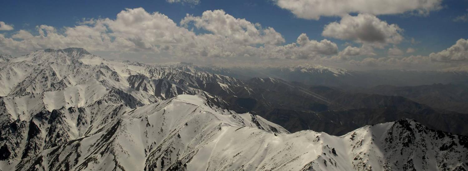
Thursday, 14 December
![]()
Cryosphere, climate and capitalism: drivers of Central Asian water stress
CIRES’ Alice Hill looked at the social and physical factors that control the flow of water in the Naryn River in Krygyzstan (Central Asia) to inform water management adaptation planning in the water-stressed region. Hill highlights the importance of climate-sensitive meltwater to Central Asia’s trans-boundary rivers and groundwater systems. Together with CIRES co-authors Cholpon Minbaeva and Alana Wilson, Hill gathered hydro-chemical and isotope data from water sampling (that she uses for mixing models), remote sensing data products, and community surveys. Social, political, and climate pressures dictate the need for creative and proactive solutions to water management in Central Asia.
Alice Frances Hill (CIRES & CU Boulder) C42B-02, 10:35 - 10:50, Convention Center 278-279
Early precursors to breakup of the Larsen Ice Shelves, Antarctica
CIRES/NSIDC’s Ted Scambos identified the proximal processes that caused the break-up of the Larsen A and Larsen B ice shelves in 1995 and 2002: extensive surface melt lakes and hydrofracture. Here, he will discuss earlier precursors to disintegration that coincide with reduced sea ice cover and increased foehn winds. Ice flow speed increases, lowering of the ice shelf surface, and changes at the margins suggest that either ocean-driven basal melt or the increased surface meltwater weaken the shelf early on, setting the stage for breakup.
Ted Scambos (CIRES’ National Snow and Ice Data Center, CU Boulder)
C42A-03, 10:50 - 11:05, Convention Center 275-277
The rise of the Hindu Kush and its role in the South Asian monsoon (Invited)
CIRES Fellow Peter Molnar discusses the Hindu Kush, which stretches west from the Karakorum into Afghanistan. Though relatively small in both height and lateral extent among high Asian terrain, it seems to play a more crucial role than the Himalaya or Tibet in enabling a strong monsoon to develop over South Asia. Recent GPS data and other observations suggest that the Hindu Kush has risen to ~3000 m since ~10 Ma. Hence it may have affected the development of the South Asia monsoon since that time.
Peter Molnar, CIRES and CU Boulder
T42B-03, 10:50 - 11:05, Convention Center 211-213
THURSDAY MORNING POSTERS
08:00 - 12:20
All sessions take place in Convention Center Poster Hall D-F.
The extreme 2015/16 El Niño, in the context of historical climate variability and change (poster GC41B-1012)
CIRES’ Matt Newman and colleagues report that the 2015/16 El Niño was a strong but not unprecedented warm event in the eastern equatorial Pacific, comparable to events occurring every few decades or so. However, central equatorial Pacific 2015/16 warmth was unprecedented in four of the five sea-surface temperature reconstruction datasets they evaluated. This exceptional warmth was unlikely, although not impossible, to have entirely occurred naturally, and appears to partly reflect an anthropogenically-forced trend. Matthew Newman (CIRES & NOAA)
Results from the first 118 GHz passive microwave observations over Antarctica (poster A41I-2411)
Richard McAllister discusses the successful collaborative effort to fly a miniaturized microwave sensor onboard NASA’s DC-8 in Operation Ice Bridge over Antarctica in late 2016. This “MiniRad” device collected data on clouds, sea, ice, ice sheets, and mountains. The instrument is planned for launch into orbit in 2018. Richard McAllister with CIRES co-author Dave Gallaher (National Snow and Ice Data Center, CU Boulder)
Recent developments of the GLIMS glacier database (poster C41B-1199)
CIRES/NSIDC’s Bruce Raup highlights improvements and regional additions to the GLIMS glacier database, Global Land Ice Measurements from Space. GLIMS, which maps glacier outlines, lakes and other topographical features, is now globally complete. The database tracks glacier measurements over time, too, and about ⅓ of glaciers in the database now have outlines from more than one time. The result of this work is a more complete and accurate data repository that shows both the current state of glaciers on Earth and how they have changed in recent decades. Bruce Raup (CIRES’ National Snow and Ice Data Center, CU Boulder)
THURSDAY AFTERNOON PRESENTATIONS
Times and locations as indicated below
Integrating observations and models to better understand a changing Arctic sea ice cover (Invited)
CIRES/NSIDC’s Julienne Stroeve highlights the urgent need to improve our understanding of the drivers behind Arctic sea ice loss and inform policy makers in our rapidly changing world. In recent years, Arctic sea ice has seen many record lows and ice extent anomalies—with 2017 marking the 3rd year in a row with a new record low for the winter maximum extent. Stroeve will discuss the CMIP6 Sea-Ice Model Intercomparison Project (SIMIP), which will fight biases and errors in sea ice simulations by combining models and observational data to improve our knowledge of future sea ice cover and its impacts on global climate. Julienne Stroeve (CIRES’ National Snow and Ice Data Center, CU Boulder) GC43J-05, 14:40 - 14:55, Convention Center 267-268
Quantifying emissions of NH3 and NOx from agricultural sources and biomass burning using SOF
CIRES Fellow Rainer Volkamer developed and used a powerful instrument, the University of Colorado Solar Occultation Flux (CU SOF), to quantify emissions of gases that are relevant to air quality. In 2014, Volkamer and his team used the innovative instrument during the Front Range Air Pollution and Photochemistry Experiment (FRAPPE). They measured fluxes of NH3, and NOx from animal feeding operations, recording per-head figures that are on the upper end of other estimates. Volkamer will also discuss an October deployment of the instrument to a California wildfire. Rainer M Volkamer (CIRES & CU Boulder) A44A-03, 16:28 - 16:40, Convention Center 398-399
How will we ensure the long-term sea ice data record continues?
Sea-ice data collected via passive microwave satellites over the last four-plus decades comprise one of the longest climate data records available. However, the current operational satellite imager (F18) is seven years old and there is no follow-on mission planned. CIRES/NDISC’s Julienne Stroeve discusses other types of sensors that may contribute the data record, but notes that a series of replacement microwave sensors is urgently needed to provide daily monitoring of the Arctic, to better delineate ice edges for safer ship navigation and other Arctic operations. Julienne Stroeve (CIRES’ National Snow and Ice Data Center, CU Boulder) C44B-08, 17:45 - 18:00, Convention Center 275-277
THURSDAY AFTERNOON POSTERS
13:40 -18:00 Convention Center Poster Hall D-F.
Continuous time-resolved regional methane leak detection with on-line background estimation using a novel combination of dual frequency comb laser spectroscopy and atmospheric inversions (poster A41F-2354)
CIRES’ Caroline Alden presents a novel method for detecting methane leaks using a dual frequency comb spectrometer —tested successfully in rural Colorado, where it picked up an intermittent and very small controlled leak from 1 km away. Advances in natural gas extraction technology have led to increased U.S. production and transport. Current leak detection methods provide only snapshot estimates of emissions, but the system her team deploys is capable of continuous, autonomous, leak detection and quantification over large areas. Alden will present the results of controlled-leak field tests in rural Colorado and of leak-detection tests in active oil and gas fields in the Denver Julesburg Basin, where background methane is complex. Caroline Alden (CIRES & NOAA & CU Boulder)
Geodetic imaging and tsunami modeling of the 2017 coupled landslide-tsunami event in Karrat Fjord, West Greenland (poster NH43A-0182)
CIRES Fellow Mike Willis used a variety of satellite and airborne remote sensing data and techniques to rapidly assess the deadly Karrat Fjord Tsunami that occurred in western Greenland in 2017. His team combined information from different sensors with ground data from locals to quickly prepare reports on a landslide that crashed off a steep south-facing wall of a fjord and into the ocean. Their work helped determine the cause of the tsunami, the size of the landslide and wave, and whether there was continuing risk of further landslides. Mike Willis and Magali Barba (CIRES & CU Boulder)
Friday, 15 December
![]()
FRIDAY MORNING PRESENTATIONS
Times and locations as indicated below
Investigating Deliquescence of Mars-like soils from the Atacama Desert and implications for liquid water near the Martian surface
Rensselaer Polytechnic Institute’s Abbey Mara Van Alstyne-Ponce discusses chemical and physical processes of salts found in the Atacama Desert. The Atacama desert is a common analog for Martian environments because it’s one of the driest deserts on Earth. She and her colleagues used an innovative Raman microscopy technique to investigate solid-liquid phase transitions of salts from the Atacama Desert. Under Mars-relevant laboratory conditions, the salts could take liquid form, suggesting that liquid solutions may be stable, in some conditions, on the surface of Mars.
Abbey Mara Van Alstyne (Rensselaer Polytechnic Institute) with CIRES Fellow Margaret A Tolbert and CIRES’ Raina V Gough and Katherine Primm (CIRES & CU Boulder)
P51H-02, 08:10 - 08:15, Convention Center R02-R03
Using the CLEAN educational resource collection for building 3D lessons to teach the climate system
CIRES’ Anne Gold presents a powerful tool in climate education: the Climate Literacy and Energy Awareness Network (CLEAN) and how it supports system thinking. CLEAN provides 700 peer-reviewed, classroom resources on climate and energy topics to educators—available at cleanet.org. The network uses Next Generation Science Standards which encourages a 3-dimensional thinking approach for climate education—key in teaching students to understand climate systems and supporting mitigation and adaptation strategies.
Anne Gold (CIRES)
ED52A-02, 10:35 - 10:50, Convention Center, 242
Formation of a CliC/CLIVAR Northern Oceans Regional Panel to advance the understanding of the role of the Arctic in global climate
CIRES’ Amy Solomon in NOAA’s Physical Sciences Laboratory highlights how a new international panel, the CliC/CLIVAR Northern Oceans Regional Panel, is helping monitor, understand, and predict climate in the changing Arctic. With its lower sea ice extent and increasingly younger, thinner sea ice, the “New Arctic” climate regime is not yet fully understood, nor is its global influence. CliC/CLIVAR is meant to help advance scientific understanding of the important region.
Amy Solomon (CIRES & NOAA)
U52A-02, 10:51 - 11:19, Convention Center E2
Mid-latitude ozone depletion events caused by halogens from the Great Salt Lake
During a 2017 wintertime study in Utah, CIRES and NOAA’s Dorothy Fibiger and colleagues observed many ozone depletion events and determined the cause: halogens from a magnesium plant on the shore of the Great Salt Lake. No natural sources of halogens were found. These highly reactive chemicals were found in extremely high levels over the Great Salt Lake close to the plant and periodically caused the destruction of ozone above the lake and in nearby valleys.
Dorothy L Fibiger (CIRES & NOAA)
A52B-08, 11:50 - 12:05, Convention Center 393-394
FRIDAY MORNING POSTER
08:00 -12:20
Convention Center Poster Hall D-F
Regional trend analysis of surface ozone observations from monitoring networks in eastern North America, Europe and East Asia (poster A51F-2132)
NOAA’s Kai-Lan Chang (a National Research Council Fellow) and several CIRES co-authors used data from the Tropospheric Ozone Assessment Report (TOAR) and a generalized additive mixed model (GAMM) technique to identify regional surface ozone trends around the globe. Surface ozone can be detrimental to human and ecosystem health. The team found that people and plants in East Asia have the greatest exposure to the pollutant and that levels are dropping over many parts of eastern North America and Europe. Kai-Lan Chang (NOAA Boulder) with several CIRES co-authors
FRIDAY AFTERNOON PRESENTATIONS
Times and locations as indicated below
SESSION: Quantifying tropospheric ozone’s present-day distribution and trends from the perspective of human health, climate, and ecosystem productivity I
Convener Owen Cooper (CIRES & NOAA)
Session A54E, 16:00 - 18:00, Convention Center 393-394
The Tropospheric Ozone Assessment Report (TOAR): A community-wide effort to quantify tropospheric ozone in a rapidly changing world
CIRES’ Owen Cooper presents the Tropospheric Ozone Assessment Report (TOAR), initiated by International Global Atmospheric Chemistry Project. TOAR harnesses the power of 220 member scientists and air quality specialists from 36 nations to create a thorough, up-to-date scientific assessment of tropospheric ozone distribution around the globe. Tropospheric ozone is a greenhouse gas and pollutant detrimental to human health and crop and ecosystem productivity. This effort highlights regions of the world with the greatest ozone exposure for humans and crops/ecosystems as well as regions where air quality is improving and where it has degraded.
Owen Cooper (CIRES & NOAA)
A54E-02, 16:15 - 16:30, Convention Center 393-394
Quantifying the impact of anthropogenic pollution on cloud properties derived from ground based remote sensors at the North Slope of Alaska
CIRES and NOAA’s Maximilian Maahn compared liquid cloud observations from two sites in northern Alaska to identify aerosols that have the potential to influence cloud properties and local climate. The sites are both coastal and are similar with respect to large scale weather patterns. While the Utqiaġvik site (formerly known as Barrow) is located in an area with few human activities, the Oliktok Point site is close to the Prudhoe Bay Oil Field— the largest oil field in North America. By comparing cloud observations from both sites, Maahn investigated how Arctic clouds are modified by emissions from the Prudhoe Bay Oil Field.
Maximilian Maahn (CIRES & NOAA)
A54D-02, 16:15 - 16:30, Convention Center 392
FRIDAY AFTERNOON POSTERS 13:40 - 18:00
All sessions take place in Convention Center Poster Hall D-F.
Committed warming inferred from observations and an energy balance model (poster GC53A-0856)
CIRES and NOAA’s Robert Pincus used an observational-based quantification method to identify the Earth’s warming “commitment” due to past emissions and found that even if fossil fuel emissions were to suddenly cease today, warming will continue. Pinus calculated this “committed warming” to be 1-2K within this century (compared to pre-industrial levels) which may warming is already on track already to exceed the 1.5K target set in Paris. Regular updates of these committed warming estimates can provide guidance to scientists and decision makers moving forward in a changing world. Robert Pincus (CIRES & NOAA)
Religious burning as a major source of atmospheric fine aerosols in Lhasa City in the Tibetan Plateau (poster GC53C-0902)
A Chinese-led team with CIRES and NOAA co-authors collected the first field measurements of aerosol size distributions in Lhasa, Tibetan Plateau. They found that concentrations of fine particles—a size that can harm people’s lungs—peaked during religious holidays that included ceremonial burnings. Air quality has been at risk in this region of high altitude and harsh climate, yet air quality studies have been limited. The team’s results suggest that further studies of religious burning, a currently under-studied source, are needed on the Tibetan Plateau and in other regions of the world where religious burnings are frequently practiced. Shang Liu (University of Science and Technology of China) with CIRES and NOAA Boulder authors
Simulation of current and projected montane snowpacks for the preservation of the wolverine in the Western U.S. (poster C53A-1006)
Wolverine rely on snow-covered areas in the Western United States for denning refugia in the spring. Yet, models predicting climate-related changes in their habitat have lacked an important component: information about topography and how north-facing slopes may be more hospitable in a warmer world. A team of University of Colorado, CIRES and NOAA researchers set about improving our understanding of future snow reductions in the mountain regions the wolverine calls home. They used a high-resolution snowpack model to incorporate topographical analysis that previous studies have lacked—results provide a unique look into snowpack losses during drought years, and an overall fragmentation of land with suitably deep snow for refuge. Aaron Heldmyer (CIRES & CU Boulder) with other CIRES and NOAA co-authors