Mike Hardesty
CIRES Senior Research Scientist and Director of CIRES Environmental Observa
- Ph.D., Naval Postgraduate School, 1984
Research Interests
My research interests center around development, evaluation, and application of optical remote sensing techniques to investigate atmospheric processes. Lidar techniques can be used to investigate a broad range of phenomena, including boundary layer dynamics, winds and turbulence, air pollution, and greenhouse gas emissions. My colleagues and I deploy lidars to obtain measurements from a variety of stationary and moving platforms, including surface vehicles, ships, aircraft, and satellites. Results of this research improve understanding, modeling, and forecasting of weather and climate processes, identify sources of particulate and gaseous air pollution, and enhance renewable energy production.
Current Research
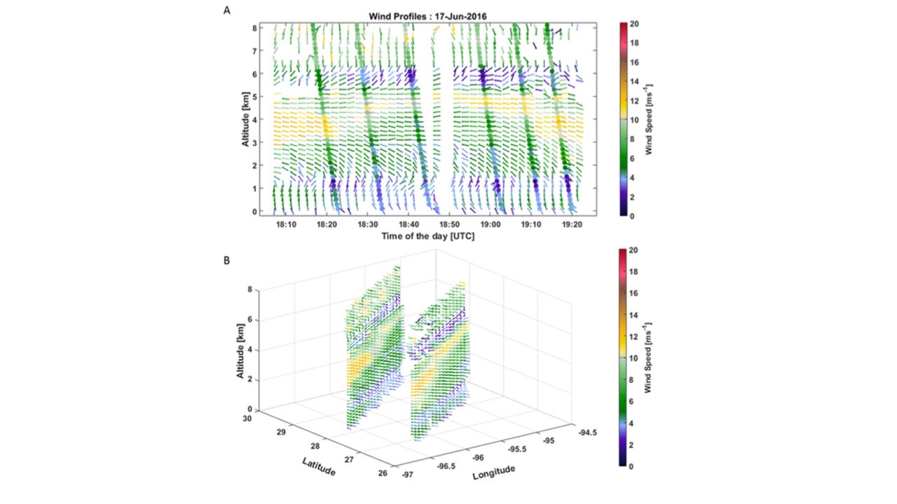
My current research is focused on developing and deploying a Doppler lidar in space to measure wind profiles globally. Currently, observations of wind profiles come primarily from radiosondes and aircraft, and are concentrated over land masses and in the northern hemisphere. Scatterometer and atmospheric motion vectors provide additional wind information but are limited in vertical extent. Observing system simulation experiments (OSSEs) indicate that space-based Doppler wind measurements assimilated into numerical forecast models will significantly improve short and medium range weather forecasts as well as reanalysis data sets used in climate studies. Working with Ball Aerospace and a CIRES postdoc, we have been investigating the performance and potential for space deployment of an Optical Autocovariance Wind Lidar (OAWL) based on a Mach-Zender interferometer to measure Doppler shift. The instrument was developed at Ball and tested on a NASA WB-57 aircraft during the summer of 2016 (Figure 1). The OAWL instrument concept is potentially well-suited for a space mission, offering the capability of measuring winds based on scatter of laser light from both molecules and aerosols using one laser transmitter and a single receiver. Primary goal of the WB-57 flights was to assess the accuracy and precision of the instrument and to verify the model used to estimate performance of such a lidar from space. Dropsondes deployed during each flight provided comparison observations to assess accuracy of the lidar measurements. I am also working with ESA on their space-based lidar winds mission Aeolus. Aeolus has just completed a very successful 4-year mission to measure winds from space using a Doppler lidar operating in the ultraviolet spectral region. Assimilation of Aeolus measurements into operational winds models demonstrated the improvement in weather forecasts available from lidar measurements. Both NOAA and ESA are examining Doppler lidar techniques for future space-BASED wind measurements in the 2030 time FRAME.
Research Categories
Atmosphere, Climate and Weather, SpaceResearch Images
Honors and Awards
to
Invalid date -Sponsors
-
Invalid dateP.I.(s)
About CECA
CECA connects and creates a supportive environment for graduate students and postdocs who come from various academic units to do research in CIRES.
