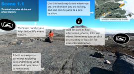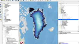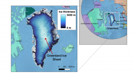
QGreenland is a free mapping tool to support interdisciplinary Greenland-focused research, teaching, decision making, and collaboration. More specifically, QGreenland is a full geospatial data package that runs on the free and open source QGIS software (www.qgis.org). With QGreenland, anyone can explore a wide variety of Greenland-focused geospatial data in their office, lab, classroom, or even in the field.
QGreenland is a National Science Foundation EarthCube-funded effort (award #1928393). Project development began in 2019, led by the National Snow and Ice Data Center, which is a part of the University of Colorado Boulder Cooperative Institute for Research in Environmental Sciences. The project is made possible through the generous efforts of a wide range of collaborators.
To learn more about QGreenland and download the QGreenland data package, visit the QGreenland website.