Risky development
The number of structures at risk from natural hazards is on the rise in the United States
Press Release
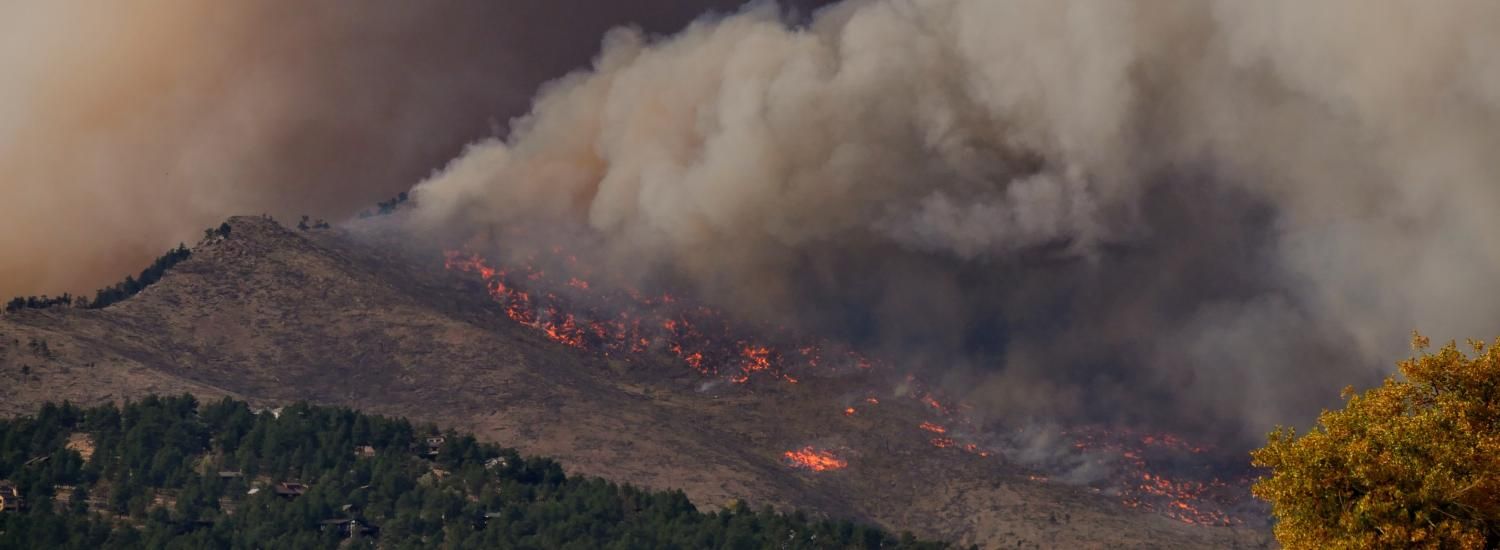
More than half of the structures in the contiguous United States are exposed to potentially devastating natural hazards—floods, tornadoes, wildfires and more—according to a new CU Boulder-led paper. Increasing temperatures and environmental changes contribute to this trend, and the work published this week in Earth’s Future shines the light on another culprit—the way humans develop open land, towns, and cities.
“We know that climate change is increasing the risk of damage from some natural hazards,” said Virginia Iglesias, a research scientist with the university’s Earth Lab and lead author of the paper. “But are losses also increasing because of the way that we are developing our cities, our towns?"
Yes, the new analysis found. To evaluate the impact of development on natural hazard risk, Iglesias and her colleagues built maps of earthquake, flood, hurricane, tornado, and wildfire hazards and compared them to a unique dataset of historical land-use derived from Zillow’s housing and property database. The team identified natural hazard “hotspots” by mapping where the probability or magnitude of an individual natural hazard event fell in the top 10 percent.
“Since development patterns drive exposure and loss, more detailed mapping can improve national-scale risk assessments,” Iglesias said. “This study fills a gap by exploring changes in hazard exposure across the country, at fine resolution, for multiple hazards, and over long periods."
The study shows that 57% of the structures in the contiguous United States are located in natural hazard hotspots; these hotspots make up only about a third of the total land. About 1.5 million structures are located in hotspots of two or more natural hazards. Despite a national slowdown in development over the last decade, the number of structures in natural hazard hotspots is still increasing, the authors found.
In some hotspots, people have built protections like levees and floodwalls, the authors noted in the new assessment. This becomes an interesting question for further research: can that infrastructure protect properties from hazardous events in the future?
The study also looked into regional development patterns that affect hazard risk. In hurricane and earthquake hotspots, for example, the primary driver for an increase in risk was the fact that people were adding buildings, homes, and other structures to already developed areas in cities and suburbs. In wildfire, flood, and tornado hotspots, it was the expansion of new buildings in rural areas and wildlands that increased risk of damage.
Iglesias and her colleagues suggest that local decision makers could use the methods innovated in this study to improve risk assessments in their purview and to better understand the socio-economic variables that might increase the risk exposure of neighborhoods or communities.
“Vulnerability matters. There’s evidence that natural disasters exacerbate socio-economic inequality,” Iglesias said. “If we want to make decisions that effectively increase the ability of communities to cope with natural hazards, we need to know where vulnerable populations live, and the specific hazards they’re exposed to.”